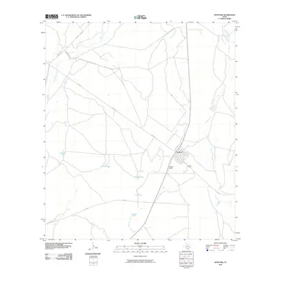
2010 Map of Spofford
USGS Topo · Published 2010About this map
Spofford serves as a small rail and road junction in the brush country of Kinney County, defined by its position at the intersection of N Railroad St and Standart Rd. The landscape is characterized by a network of intermittent watercourses including Las Moras Creek, Salado Creek, and Imperialist Creek, which carve through the arid terrain. Local infrastructure is heavily oriented toward ranching and transit, evidenced by the numerous named livestock water sources like Red Barn Tank, Gaebler Tanks, and Yellow Tank scattered across the quadrangle. For those researching local family history, Vincent Cemetery is located just southeast of the main settlement near F-M 1572. The presence of the Spofford Airport and several Farm to Market roads like F-M 1908 and F-M 1909 highlights the area's continued role as a regional connector in Southwest Texas.
Find a feature on this map
20 named features on this map. Tap any name to fly to it.
Don’t see what you’re looking for? This feature index may not catch every label — zoom into the map to look around manually.
Map Details
Editions of this 2010 Spofford Map
This is the sole edition of this map. No revisions or reprints were ever made.
Other maps of this area

1896 · Brackett
USGS Topo · 1:125,000

1897 · Brackett
USGS Topo · 1:125,000

1941 · Standart
USGS Topo · 1:62,500

1941 · Tequesquite Creek
USGS Topo · 1:62,500

1943 · Standart
USGS Topo · 1:62,500

1944 · Tequesquite Creek
USGS Topo · 1:62,500

1944 · Spofford
USGS Topo · 1:62,500

1944 · Brackettville
USGS Topo · 1:62,500

1958 · Del Rio
USGS Topo · 1:250,000

1964 · Del Rio
USGS Topo · 1:250,000