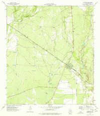
1974 Map of Spofford
USGS Topo · Published 1977About this map
Spofford serves as the central hub of this South Texas landscape, defined by its position at a significant junction of the Southern Pacific railroad. The town's grid is small but orderly, situated in a region of Kinney County characterized by ephemeral water sources and ranching infrastructure. Numerous man-made water catchments, such as Double Tank, Gaebler Tanks, and Red Barn Tank, are distributed across the terrain to support livestock where Salado Creek and Moro Creek provide seasonal drainage.
Find a feature on this map
18 named features on this map. Tap any name to fly to it.
Don’t see what you’re looking for? This feature index may not catch every label — zoom into the map to look around manually.
Map Details
Editions of this 1974 Spofford Map
This is the sole edition of this map. No revisions or reprints were ever made.
Other maps of this area

1896 · Brackett
USGS Topo · 1:125,000

1897 · Brackett
USGS Topo · 1:125,000

1941 · Standart
USGS Topo · 1:62,500

1941 · Tequesquite Creek
USGS Topo · 1:62,500

1943 · Standart
USGS Topo · 1:62,500

1944 · Tequesquite Creek
USGS Topo · 1:62,500

1944 · Spofford
USGS Topo · 1:62,500

1944 · Brackettville
USGS Topo · 1:62,500

1958 · Del Rio
USGS Topo · 1:250,000

1964 · Del Rio
USGS Topo · 1:250,000