
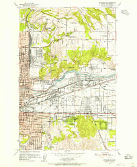
1950 Map of Spokane NE
USGS Topo · Published 1952About this map
Spokane River meanders through this mid-century landscape, separating the residential expansions of Hillyard and East Spokane from the agricultural expanses of Orchard Prairie and Pleasant Prairie. The map captures a moment of significant infrastructure, showing the Spokane Valley as a major transit corridor where the Great Northern, Union Pacific, and Spokane International railroads converge near Yardley.
Find a feature on this map
89 named features on this map. Tap any name to fly to it.
Don’t see what you’re looking for? This feature index may not catch every label — zoom into the map to look around manually.
Map Details
Editions of this 1950 Spokane NE Map
2 editions found
Other maps of this area

1901 · Spokane
USGS Topo · 1:125,000

1943 · Mt Spokane
USGS Topo · 1:62,500

1949 · Deer Park
USGS Topo · 1:62,500

1949 · Greenacres
USGS Topo · 1:62,500

1950 · Spokane SE
USGS Topo · 1:24,000

1950 · Mt Spokane
USGS Topo · 1:62,500

1950 · Spokane SW
USGS Topo · 1:24,000

1950 · Spokane NW
USGS Topo · 1:24,000

1950 · Spokane
USGS Topo · 1:62,500

1951 · Deer Park
USGS Topo · 1:62,500