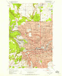
1950 Map of Spokane NW
USGS Topo · Published 1958About this map
Spokane spreads across the plateau and canyon lands during the early postwar years, revealing a city defined by its educational institutions and military presence. Higher education is anchored by the riverfront campus of Gonzaga University and the Holy Names College, while the northwestern reaches are dominated by the George Wright Air Force Base and a sprawling Naval Reservation. The topography is stark, transitioning from the flat expanse of Five Mile Prairie to the steep Palisades and the winding Spokane River valley. This 1950 survey shows an extensive rail network including the Great Northern and Spokane International lines, which supported the region's industrial growth. From the numerous neighborhood schools like North Central HS to the outlying Calkins Air Terminal, the map documents the infrastructure of a regional hub in a period of significant expansion.
Find a feature on this map
90 named features on this map. Tap any name to fly to it.
Don’t see what you’re looking for? This feature index may not catch every label — zoom into the map to look around manually.
Map Details
Editions of this 1950 Spokane NW Map
2 editions found
Other maps of this area

1901 · Spokane
USGS Topo · 1:125,000

1943 · Medical Lake
USGS Topo · 1:62,500

1944 · Clayton
USGS Topo · 1:62,500

1949 · Deer Park
USGS Topo · 1:62,500

1950 · Spokane NE
USGS Topo · 1:24,000

1950 · Spokane SE
USGS Topo · 1:24,000

1950 · Spokane SW
USGS Topo · 1:24,000

1950 · Spokane NW
USGS Topo · 1:24,000

1950 · Spokane
USGS Topo · 1:62,500

1950 · Clayton
USGS Topo · 1:62,500