
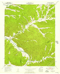
1936 Map of Spot
USGS Topo · Published 1936About this map
Sugar Creek and its many forks define the rural landscape of this middle Tennessee region, where the borders of Hickman, Humphreys, and Dickson counties converge. Compiled from early aerial photography by the Tennessee Valley Authority and USGS, the map reveals a highly dispersed settlement pattern centered around small schoolhouses and country churches. The hamlet of Spot sits near the southern edge, supported by the Spot Sch and nearby Coleman Cem.
Find a feature on this map
66 named features on this map. Tap any name to fly to it.
Don’t see what you’re looking for? This feature index may not catch every label — zoom into the map to look around manually.
Map Details
Editions of this 1936 Spot Map
This is the sole edition of this map. No revisions or reprints were ever made.
Other maps of this area

1901 · Colombia
USGS Topo · 1:125,000

1936 · Gorman
USGS Topo · 1:24,000

1936 · Coble
USGS Topo · 1:24,000

1936 · Nunnelly
USGS Topo · 1:24,000

1936 · Whitfield
USGS Topo · 1:24,000

1936 · Bucksnort
USGS Topo · 1:24,000

1936 · Texas Hollow
USGS Topo · 1:24,000

1936 · Tennessee City
USGS Topo · 1:24,000

1936 · Dickson
USGS Topo · 1:24,000
1952 · Bucksnort
USGS Topo · 1:24,000