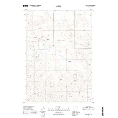
2017 Map of Spotted Horse
USGS Topo · Published 2017About this map
Spotted Horse sits at the junction of Highway 14/16, serving as the primary landmark in this high-plains landscape of Campbell County. The drainage patterns of the Powder River Basin define the topography, with a complex network of draws such as Rucker Draw, Store Draw, and New Deal Draw cutting through the terrain. These ephemeral waterways are critical to the region's ranching heritage, feeding into larger systems like Spotted Horse Cr and L X Bar Cr.
Find a feature on this map
28 named features on this map. Tap any name to fly to it.
Don’t see what you’re looking for? This feature index may not catch every label — zoom into the map to look around manually.
Map Details
Editions of this 2017 Spotted Horse Map
This is the sole edition of this map. No revisions or reprints were ever made.
Other maps of this area

1954 · Gillette
USGS Topo · 1:250,000

1955 · Gillette
USGS Topo · 1:250,000

1958 · Gillette
USGS Topo · 1:250,000

1962 · Gillette
USGS Topo · 1:250,000

1971 · Larey Draw
USGS Topo · 1:24,000
1971 · Reservoir Creek
USGS Topo · 1:24,000
1971 · Kline Draw
USGS Topo · 1:24,000

1971 · Wildcat
USGS Topo · 1:24,000
1971 · Homestead Draw SW
USGS Topo · 1:24,000

1971 · Recluse
USGS Topo · 1:24,000