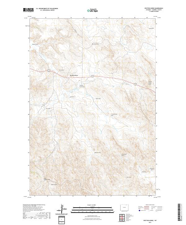
2021 Map of Spotted Horse
USGS Topo · Published 2021About this map
Spotted Horse sits at the center of this Campbell County landscape, where the high plains of northern Wyoming are defined by an intricate network of drainage draws and seasonal creeks. The terrain is marked by family and descriptive landmarks such as Sorenson Draw, Rucker Draw, and Linn Draw, reflecting a ranching heritage where water sources and topographic relief dictate the placement of local infrastructure. Near the settlement, Endgate Reservoir and Spotted Horse Cr provide critical water management in an area otherwise characterized by dry gulches. The survey captures the transition across Chicken Creek Divide, showing the importance of named features like New Deal Draw and Washout Draw for navigating this section of the Powder River Basin. This modern update preserves the historic names of the draws and divides that have long oriented travelers along Werner Rd and the surrounding rangeland.
Find a feature on this map
28 named features on this map. Tap any name to fly to it.
Don’t see what you’re looking for? This feature index may not catch every label — zoom into the map to look around manually.
Map Details
Editions of this 2021 Spotted Horse Map
This is the sole edition of this map. No revisions or reprints were ever made.
Other maps of this area

1954 · Gillette
USGS Topo · 1:250,000

1955 · Gillette
USGS Topo · 1:250,000

1958 · Gillette
USGS Topo · 1:250,000

1962 · Gillette
USGS Topo · 1:250,000

1971 · Larey Draw
USGS Topo · 1:24,000
1971 · Reservoir Creek
USGS Topo · 1:24,000
1971 · Kline Draw
USGS Topo · 1:24,000

1971 · Wildcat
USGS Topo · 1:24,000
1971 · Homestead Draw SW
USGS Topo · 1:24,000

1971 · Recluse
USGS Topo · 1:24,000