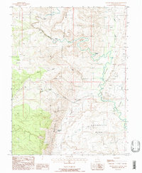
1988 Map of Spotted Wolf Canyon
USGS Topo · Published 1988About this map
The San Rafael River meanders through a labyrinth of high desert terrain in this late-1980s survey, illustrating the complex drainage patterns of the San Rafael Reef. Industrial interest in the area is evidenced by numerous prospects and adits concentrated near Tidwell Draw, signaling a history of mineral exploration in the canyon country. Notable geographic landmarks such as Swazys Leap and the Natural Arch punctuate the landscape, while colorful local nomenclature like Jackass Benches and Moonshine Tanks reflects the region's human history. Modern infrastructure, including a Runaway Truck Ramp and a highway Rest Area, marks the path of travel through Spotted Wolf Canyon, showing how late 20th-century transportation adapted to the dramatic elevation changes of The Squeeze and the broad flats of Shadscale Mesa.
Find a feature on this map
23 named features on this map. Tap any name to fly to it.
Don’t see what you’re looking for? This feature index may not catch every label — zoom into the map to look around manually.
Map Details
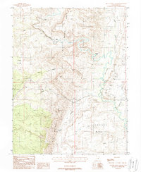
Editions of this 1988 Spotted Wolf Canyon Map
2 editions found
Other maps of this area

1885 · San Rafael
USGS Topo · 1:250,000

1886 · Price River
USGS Topo · 1:250,000

1896 · Price River
USGS Topo · 1:250,000

1953 · Red Plateau SE
USGS Topo · 1:24,000

1953 · Tidwell 2 SW
USGS Topo · 1:24,000

1953 · Beckwith Peak SW
USGS Topo · 1:24,000

1953 · Tidwell 2 NW
USGS Topo · 1:24,000

1954 · Stinking Spring Creek 1 SE
USGS Topo · 1:24,000

1954 · Stinking Spring Creek 1 NE
USGS Topo · 1:24,000

1954 · Tidwell 2 SE
USGS Topo · 1:24,000