
2014 Map of Sprague River East
USGS Topo · Published 2014About this map
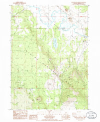
The Sprague River meanders through the Northern Oregon landscape, defining the character of the Sprague River Valley at the beginning of the 21st century. This region is characterized by significant topographical elevation changes, transitioning from the broad Cliney Flat and Dams Meadow to the high points of Council Butte and Bly Mtn. Much of the southern and eastern portion of the map is dominated by the Winema National Forest, where the terrain rises toward Yainax Ridge. Local history is anchored by the Rock Creek Cem and Jackson Cem, while the northern section shows an organized grid of residential streets with names like Cowlitz St and Walla Walla St, reflecting a planned expansion in a largely rural timber and ranching area. Water resources are vital to this geography, including Muckney Lake, Horton Reservoir, and several named springs such as Rattlesnake Spring.
Find a feature on this map
58 named features on this map. Tap any name to fly to it.
Don’t see what you’re looking for? This feature index may not catch every label — zoom into the map to look around manually.
Map Details
Editions of this 2014 Sprague River East Map
This is the sole edition of this map. No revisions or reprints were ever made.
Other maps of this area

1889 · Klamath
USGS Topo · 1:250,000

1894 · Klamath
USGS Topo · 1:250,000

1955 · Klamath Falls
USGS Topo · 1:250,000

1956 · Calimus Butte
USGS Topo · 1:62,500

1957 · Swan Lake
USGS Topo · 1:62,500

1958 · Klamath Falls
USGS Topo · 1:250,000

1960 · Beatty
USGS Topo · 1:62,500

1960 · Fuego Mountain
USGS Topo · 1:62,500

1980 · Williamson River
USGS Topo · 1:100,000
1985 · Sprague River West
USGS Topo · 1:24,000