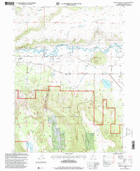
1998 Map of Sprague River East
USGS Topo · Published 2000About this map
The Sprague River Valley defines this portion of the Oregon high country, where the meandering Sprague River is flanked by an extensive system of human-made infrastructure, including a canal, spoil banks, and a pumping station. To the north, the terrain transitions into the elevated Tableland and the distinctive Knot, while the southern half of the map is dominated by the timbered slopes of the Winema National Forest.
Find a feature on this map
31 named features on this map. Tap any name to fly to it.
Don’t see what you’re looking for? This feature index may not catch every label — zoom into the map to look around manually.
Map Details
Editions of this 1998 Sprague River East Map
This is the sole edition of this map. No revisions or reprints were ever made.
Other maps of this area

1889 · Klamath
USGS Topo · 1:250,000

1894 · Klamath
USGS Topo · 1:250,000

1955 · Klamath Falls
USGS Topo · 1:250,000

1956 · Calimus Butte
USGS Topo · 1:62,500

1957 · Swan Lake
USGS Topo · 1:62,500

1958 · Klamath Falls
USGS Topo · 1:250,000

1960 · Beatty
USGS Topo · 1:62,500

1960 · Fuego Mountain
USGS Topo · 1:62,500

1980 · Williamson River
USGS Topo · 1:100,000
1985 · Sprague River West
USGS Topo · 1:24,000