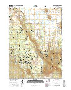
2017 Map of Sprague River West
USGS Topo · Published 2017About this map
The Sprague River meanders through the broad Sprague River Valley in this Klamath County landscape, defining a corridor of ranching and timber activity. To the north, distinctive volcanic landmarks such as Magpie Butte, Eagle Butte, and the evocative Buttes of the Gods rise sharply from the valley floor. Much of the southern and western portions of the quadrangle are protected within the Winema National Forest, where the terrain transitions into complex ridges and flats including Switchback Hill and Switchback Flat.
Find a feature on this map
40 named features on this map. Tap any name to fly to it.
Don’t see what you’re looking for? This feature index may not catch every label — zoom into the map to look around manually.
Map Details
Editions of this 2017 Sprague River West Map
This is the sole edition of this map. No revisions or reprints were ever made.
Other maps of this area

1889 · Klamath
USGS Topo · 1:250,000

1894 · Klamath
USGS Topo · 1:250,000

1955 · Klamath Falls
USGS Topo · 1:250,000

1956 · Calimus Butte
USGS Topo · 1:62,500

1957 · Swan Lake
USGS Topo · 1:62,500

1958 · Klamath Falls
USGS Topo · 1:250,000

1960 · Beatty
USGS Topo · 1:62,500

1960 · Fuego Mountain
USGS Topo · 1:62,500

1980 · Williamson River
USGS Topo · 1:100,000
1985 · Sprague River West
USGS Topo · 1:24,000