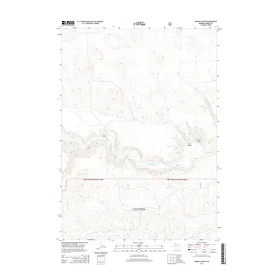
2014 Map of Spring Canyon
USGS Topo · Published 2014About this map
Sam R. McKelvie National Forest dominates the southern half of this landscape, where the sandy hills of Nebraska's interior meet the deep incision of the Niobrara River valley. This transition from the open forest and grassland to the river corridor is defined by complex drainage systems and sharp topographic relief. The river itself is crossed at Hook Bridge, a key crossing point for the local road network that navigates the steep descents into the valley. Numerous seasonal watercourses and landforms, such as Medicine Cr and Styre Canyon, carve into the plateau, illustrating the erosive power that has shaped the Cherry County terrain. In the eastern portion of the survey, Spring Canyon and Dry Cr further mark the rugged breaks leading down to the riverbed, highlighting the geographic isolation and specific transport routes required to traverse this section of the Great Plains.
Find a feature on this map
7 named features on this map. Tap any name to fly to it.
Don’t see what you’re looking for? This feature index may not catch every label — zoom into the map to look around manually.
Map Details
Editions of this 2014 Spring Canyon Map
This is the sole edition of this map. No revisions or reprints were ever made.
Other maps of this area

1950 · Powderhorn Valley
USGS Topo · 1:62,500

1950 · Cody
USGS Topo · 1:62,500

1950 · Doughboy
USGS Topo · 1:62,500

1952 · Eli
USGS Topo · 1:62,500

1952 · Doughboy
USGS Topo · 1:62,500

1957 · Valentine
USGS Topo · 1:250,000

1959 · Valentine
USGS Topo · 1:250,000

1985 · Heath Valley
USGS Topo · 1:24,000

1985 · Eli SE
USGS Topo · 1:24,000
1985 · Cody East
USGS Topo · 1:24,000