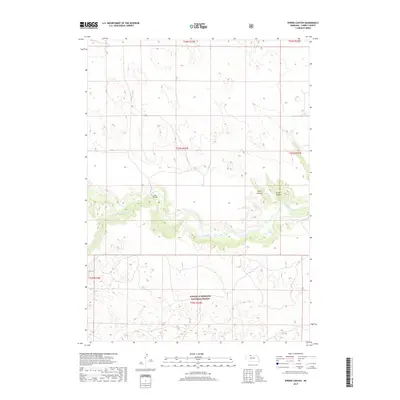
2017 Map of Spring Canyon
USGS Topo · Published 2017About this map
The Niobrara River carves a deep, winding path through this portion of Cherry County, creating a stark contrast to the surrounding sandhills. This central waterway is fed by tributaries like Medicine Cr and Dry Cr, which cut through the local topography to form distinct landforms such as Spring Canyon and Styre Canyon. The presence of Hook Bridge provides a specific point of reference for historical crossing patterns over the Niobrara.
Find a feature on this map
13 named features on this map. Tap any name to fly to it.
Don’t see what you’re looking for? This feature index may not catch every label — zoom into the map to look around manually.
Map Details
Editions of this 2017 Spring Canyon Map
This is the sole edition of this map. No revisions or reprints were ever made.
Other maps of this area

1950 · Powderhorn Valley
USGS Topo · 1:62,500

1950 · Cody
USGS Topo · 1:62,500

1950 · Doughboy
USGS Topo · 1:62,500

1952 · Eli
USGS Topo · 1:62,500

1952 · Doughboy
USGS Topo · 1:62,500

1957 · Valentine
USGS Topo · 1:250,000

1959 · Valentine
USGS Topo · 1:250,000

1985 · Heath Valley
USGS Topo · 1:24,000

1985 · Eli SE
USGS Topo · 1:24,000
1985 · Cody East
USGS Topo · 1:24,000