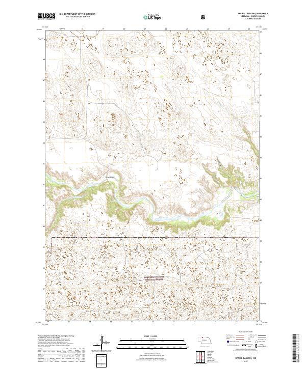
2021 Map of Spring Canyon
USGS Topo · Published 2021About this map
The Niobrara River carves a deep valley through the Nebraska Sandhills, serving as the central geographic feature of this Cherry County landscape. Its winding course is joined by tributaries including Medicine Cr and Dry Cr, creating a complex drainage system that contrasts with the surrounding high plains. Near the river's northern bend, the historic Hook Bridge provides a rare crossing point in this sparsely populated territory.
Find a feature on this map
13 named features on this map. Tap any name to fly to it.
Don’t see what you’re looking for? This feature index may not catch every label — zoom into the map to look around manually.
Map Details
Editions of this 2021 Spring Canyon Map
This is the sole edition of this map. No revisions or reprints were ever made.
Other maps of this area

1950 · Powderhorn Valley
USGS Topo · 1:62,500

1950 · Cody
USGS Topo · 1:62,500

1950 · Doughboy
USGS Topo · 1:62,500

1952 · Eli
USGS Topo · 1:62,500

1952 · Doughboy
USGS Topo · 1:62,500

1957 · Valentine
USGS Topo · 1:250,000

1959 · Valentine
USGS Topo · 1:250,000

1985 · Heath Valley
USGS Topo · 1:24,000

1985 · Eli SE
USGS Topo · 1:24,000
1985 · Cody East
USGS Topo · 1:24,000