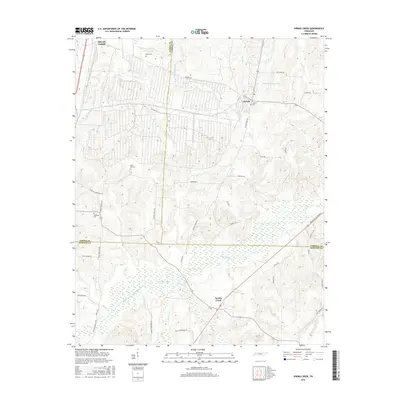
2016 Map of Spring Creek
USGS Topo · Published 2016About this map
Spring Creek lies at the convergence of three counties—Madison, Gibson, and Carroll—serving as a focal point for this agrarian landscape. The settlement of Lavinia sits to the north, while the Middle Fork Forked Deer River defines the southern portion of the terrain with its intricate wetlands and the Old River Run. This 2016 survey documents a region where local history is preserved in several small burial grounds, including Hope Hill Cem and Hopewell Cem, many of which are reached by namesake roads like Hope Hill Cemetery Rd. The drainage network is particularly dense here, featuring numerous named branches such as Halls Br, Birch Br, and Eubank Br, which feed into larger systems like Dry Cr and Spring Cr. Significant infrastructure like the Broadway of America highway and Lake Site Number 86-2 show the modern developments layered over the traditional Tennessee river bottoms.
Find a feature on this map
54 named features on this map. Tap any name to fly to it.
Don’t see what you’re looking for? This feature index may not catch every label — zoom into the map to look around manually.
Map Details
Editions of this 2016 Spring Creek Map
This is the sole edition of this map. No revisions or reprints were ever made.
Other maps of this area

1950 · Jackson North
USGS Topo · 1:24,000

1951 · Jackson North
USGS Topo · 1:24,000

1952 · Milan
USGS Topo · 1:24,000

1953 · Claybrook
USGS Topo · 1:24,000

1955 · Juno
USGS Topo · 1:24,000

1956 · Blytheville
USGS Topo · 1:250,000

1959 · Medina
USGS Topo · 1:24,000

1959 · Blytheville
USGS Topo · 1:250,000

1966 · Spring Creek
USGS Topo · 1:24,000

1966 · Mc Lemoresville
USGS Topo · 1:24,000