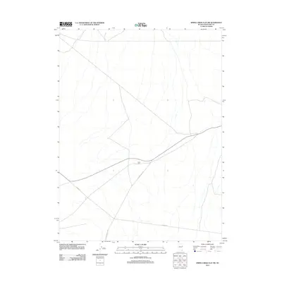
2012 Map of Spring Creek Flat NW
USGS Topo · Published 2012About this map
Prairie Gate marks a notable junction in this remote corner of White Pine County, where high-desert transportation routes converge. The map documents a sparsely settled landscape defined by early 21st-century ranching and transit patterns, anchored by the presence of Georgetta Ranch in the eastern portion of the quadrangle. The physical geography is navigated primarily by long-established thoroughfares such as Pleasant Valley Rd and the aptly named Whiskey Rd. This survey provides a precise record of the road network and sparse human footprint in the Spring Creek Flat area, serving as a baseline for understanding the connectivity between isolated homesteads and the surrounding basin terrain.
Find a feature on this map
4 named features on this map. Tap any name to fly to it.
Don’t see what you’re looking for? This feature index may not catch every label — zoom into the map to look around manually.
Map Details
Editions of this 2012 Spring Creek Flat NW Map
This is the sole edition of this map. No revisions or reprints were ever made.
Other maps of this area

1955 · Elko
USGS Topo · 1:250,000

1956 · Ely
USGS Topo · 1:250,000

1958 · Elko
USGS Topo · 1:250,000

1959 · Ely
USGS Topo · 1:250,000

1962 · Elko
USGS Topo · 1:250,000

1963 · Ely
USGS Topo · 1:250,000

1965 · Elko
USGS Topo · 1:250,000

1979 · Sunset Reservoir
USGS Topo · 1:24,000
1981 · Tippett Canyon
USGS Topo · 1:24,000
1981 · Spring Creek Flat NW
USGS Topo · 1:24,000