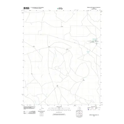
2010 Map of Spring Creek Ranch
USGS Topo · Published 2010About this map
Spring Creek Ranch and Houghton Ranch anchor this West Texas landscape, illustrating the enduring scale of cattle operations in Hartley County. The drainage network of Romero Creek and its tributary, West Fork Romero Creek, defines the local hydrology alongside several man-made impoundments like Martha Houghton Lake Number 3 and the curiously named Buttermilk Tank.
Find a feature on this map
17 named features on this map. Tap any name to fly to it.
Don’t see what you’re looking for? This feature index may not catch every label — zoom into the map to look around manually.
Map Details
Editions of this 2010 Spring Creek Ranch Map
This is the sole edition of this map. No revisions or reprints were ever made.
Other maps of this area

1954 · Tucumcari
USGS Topo · 1:250,000

1958 · Tucumcari
USGS Topo · 1:250,000

1971 · Middle Water
USGS Topo · 1:24,000

1971 · Romero SE
USGS Topo · 1:24,000

1971 · Whiteaker Ranch
USGS Topo · 1:24,000

1971 · Knoblaw
USGS Topo · 1:24,000

1971 · Spring Creek Ranch
USGS Topo · 1:24,000
1971 · Romero
USGS Topo · 1:24,000
1971 · Humdinger Spring
USGS Topo · 1:24,000

1971 · Pedarosa Camp
USGS Topo · 1:24,000