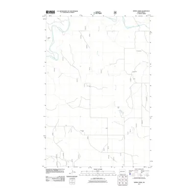
2011 Map of Spring Creek
USGS Topo · Published 2011About this map
The Little Missouri River meanders across the northwestern corner of this landscape, anchoring a rural ranching territory in Slope County. The terrain is defined by the drainage of Spring Creek, which flows southward through the center of the sheet, supported by local water management features like the Davis Dam. This area is characterized by large, isolated agricultural holdings and private estates, reflecting the modern ranching economy of western North Dakota. Named family landmarks such as the Johnson Ranch, Van Doele Ranch, and Seymanski Ranch indicate established land ownership patterns, while Rhame Rd provides the primary north-south transit corridor. The map effectively documents the distribution of ranch headquarters and the intricate network of coulees and secondary waterways, including Spring Coulee, that shape the grazing lands east of the main river valley.
Find a feature on this map
10 named features on this map. Tap any name to fly to it.
Don’t see what you’re looking for? This feature index may not catch every label — zoom into the map to look around manually.
Map Details
Editions of this 2011 Spring Creek Map
This is the sole edition of this map. No revisions or reprints were ever made.
Other maps of this area

1953 · Dickinson
USGS Topo · 1:250,000

1957 · Dickinson
USGS Topo · 1:250,000

1979 · Deep Creek North
USGS Topo · 1:24,000

1979 · Three V Crossing
USGS Topo · 1:24,000

1979 · Bullion Butte
USGS Topo · 1:24,000

1980 · Spring Creek
USGS Topo · 1:24,000

1980 · Boyce Creek West
USGS Topo · 1:24,000

1980 · Alpha
USGS Topo · 1:24,000

1980 · Belfield
USGS Topo · 1:100,000

1981 · Bowman
USGS Topo · 1:100,000