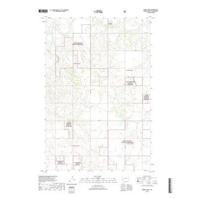
2018 Map of Spring Creek
USGS Topo · Published 2018About this map
The Little Missouri River meanders across the northwestern corner of this territory, defining a landscape largely encompassed by the Little Missouri National Grassland. This section of Slope County is characterized by a complex drainage network where Spring Cr and the Spring Coulee have carved distinct paths through the high plains. The map reflects the enduring grid of the Public Land Survey System, with township and range lines such as t136n r104w and t135n r103w organizing the open range. A sparse network of section-line roads, including 55th St SW and 160th Ave SW, provides the only modern access through these protected federal lands. The presence of Rhame Rd in the southern reaches indicates the primary corridor connecting this remote landscape to the broader region of southwestern North Dakota.
Find a feature on this map
15 named features on this map. Tap any name to fly to it.
Don’t see what you’re looking for? This feature index may not catch every label — zoom into the map to look around manually.
Map Details
Editions of this 2018 Spring Creek Map
This is the sole edition of this map. No revisions or reprints were ever made.
Other maps of this area

1953 · Dickinson
USGS Topo · 1:250,000

1957 · Dickinson
USGS Topo · 1:250,000

1979 · Deep Creek North
USGS Topo · 1:24,000

1979 · Three V Crossing
USGS Topo · 1:24,000

1979 · Bullion Butte
USGS Topo · 1:24,000

1980 · Spring Creek
USGS Topo · 1:24,000

1980 · Boyce Creek West
USGS Topo · 1:24,000

1980 · Alpha
USGS Topo · 1:24,000

1980 · Belfield
USGS Topo · 1:100,000

1981 · Bowman
USGS Topo · 1:100,000