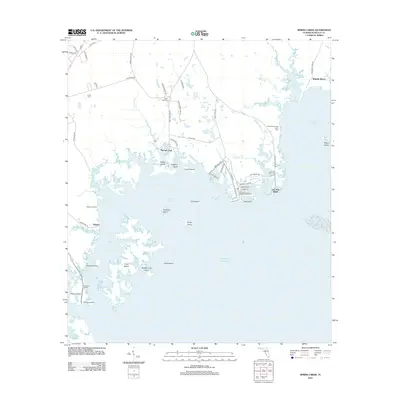
2012 Map of Spring Creek
USGS Topo · Published 2012About this map
The Gulf of Mexico dominates the southern half of this coastal landscape, where the intricate shoreline of the Florida Panhandle dissolves into a complex network of marshes, islands, and tidal creeks. The settlement of Spring Creek sits at the junction of Spring Creek Hwy and the waterfront, serving as a gateway to Stuart Cove and the surrounding coastal reaches. To the east, the coastal communities of Shell Point and Live Oak Island are defined by a series of residential streets and canals, illustrating a pattern of modern development integrated into the marine environment.
Find a feature on this map
67 named features on this map. Tap any name to fly to it.
Don’t see what you’re looking for? This feature index may not catch every label — zoom into the map to look around manually.
Map Details
Editions of this 2012 Spring Creek Map
This is the sole edition of this map. No revisions or reprints were ever made.
Other maps of this area

1940 · Arran
USGS Topo · 1:62,500

1943 · Arran
USGS Topo · 1:62,500

1943 · St. Teresa Beach
USGS Topo · 1:24,000

1943 · Lighthouse Point
USGS Topo · 1:24,000

1945 · Lighthouse Point
USGS Topo · 1:31,680

1945 · St Teresa
USGS Topo · 1:31,680

1949 · Apalachicola
USGS Topo · 1:250,000

1954 · Sprague Island
USGS Topo · 1:24,000

1954 · St. Marks
USGS Topo · 1:24,000

1954 · Tallahassee
USGS Topo · 1:250,000