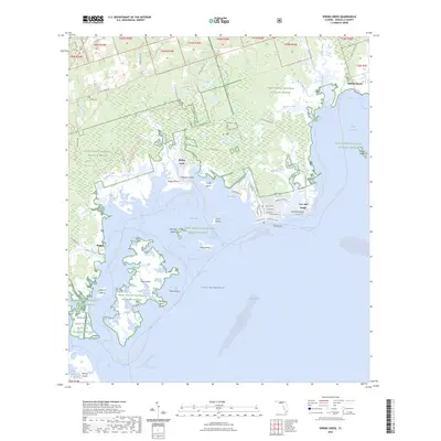
2024 Map of Spring Creek
USGS Topo · Published 2024About this map
Saint Marks National Wildlife Refuge dominates this coastal stretch of Wakulla County, where the tangled wetlands and hammocks meet the Gulf of Mexico. The landscape is defined by the labyrinthine drainages of Spring Creek and Shepherd Spring Creek, which feed into the expansive Apalachee Bay. Small coastal communities like Live Oak Island and Wakulla Beach are connected by a network of local routes including Spring Creek Hwy and Wakulla Beach Rd, highlighting the region's reliance on the sea. Inland, family histories are preserved at Smith Cem and Debra Nell Cem, while the Florida National Scenic Trl traverses the northern woodlands. The map also delineates extensive marine trails, such as the Apalachee Bay Maritime Heritage Paddling Trail System Trl, which weave through islands like Piney Island and Alligator Island.
Find a feature on this map
85 named features on this map. Tap any name to fly to it.
Don’t see what you’re looking for? This feature index may not catch every label — zoom into the map to look around manually.
Map Details
Editions of this 2024 Spring Creek Map
This is the sole edition of this map. No revisions or reprints were ever made.
Other maps of this area

1940 · Arran
USGS Topo · 1:62,500

1943 · Arran
USGS Topo · 1:62,500

1943 · St. Teresa Beach
USGS Topo · 1:24,000

1943 · Lighthouse Point
USGS Topo · 1:24,000

1945 · Lighthouse Point
USGS Topo · 1:31,680

1945 · St Teresa
USGS Topo · 1:31,680

1949 · Apalachicola
USGS Topo · 1:250,000

1954 · Sprague Island
USGS Topo · 1:24,000

1954 · St. Marks
USGS Topo · 1:24,000

1954 · Tallahassee
USGS Topo · 1:250,000