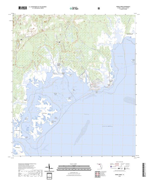
2025 Map of Spring Creek
USGS Topo · Published 2025About this map
Apalachee Bay and the interconnected wetlands of the Florida panhandle define this coastal environment, where the Gulf of America meets a complex network of marshes and tidal inlets. The settlement of Spring Creek sits as a focal point near Alligator Island and Boggy Island, reflecting a landscape deeply tied to the water. Inland, the presence of the Smith Cem and Debra Nell Cem provides grounded points of interest for genealogists and local historians, while the Florida National Scenic Trl and the Florida Circumnavigational Paddling Trl highlight the area's modern identity as a destination for navigation and transit.
Find a feature on this map
69 named features on this map. Tap any name to fly to it.
Don’t see what you’re looking for? This feature index may not catch every label — zoom into the map to look around manually.
Map Details
Editions of this 2025 Spring Creek Map
This is the sole edition of this map. No revisions or reprints were ever made.
Other maps of this area

1940 · Arran
USGS Topo · 1:62,500

1943 · Arran
USGS Topo · 1:62,500

1943 · St. Teresa Beach
USGS Topo · 1:24,000

1943 · Lighthouse Point
USGS Topo · 1:24,000

1945 · Lighthouse Point
USGS Topo · 1:31,680

1945 · St Teresa
USGS Topo · 1:31,680

1949 · Apalachicola
USGS Topo · 1:250,000

1954 · Sprague Island
USGS Topo · 1:24,000

1954 · St. Marks
USGS Topo · 1:24,000

1954 · Tallahassee
USGS Topo · 1:250,000