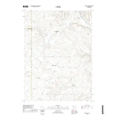
2019 Map of Spring Creek
USGS Topo · Published 2019About this map
West Spring Creek and the surrounding township occupy a landscape defined by the winding waters of Spring Cr and Brokenstraw Creek. This 2019 survey documents the rural character of the northwestern Pennsylvania borderlands where Erie, Crawford, and Warren Counties converge. The settlement patterns are anchored by small hubs like East Branch and Sanford, with family-named landmarks such as Turner Hill and Jackson Hill marking the local topography. Genealogists will find significant value in the documentation of local burial grounds, including Spring Creek Cem, East Branch Cem, and Trimm Cem. The map also captures modern infrastructure integrated into the wooded terrain, such as the Nichols Airport and the network of roads branching off Old Rte 77, illustrating the enduring spatial layout of these upland communities and their relationship to water sources like the Hemlock Lakes and Brandy Run.
Find a feature on this map
56 named features on this map. Tap any name to fly to it.
Don’t see what you’re looking for? This feature index may not catch every label — zoom into the map to look around manually.
Map Details
Editions of this 2019 Spring Creek Map
This is the sole edition of this map. No revisions or reprints were ever made.
Other maps of this area

1926 · Youngsville
USGS Topo · 1:62,500

1927 · Tidioute
USGS Topo · 1:48,000

1927 · Titusville
USGS Topo · 1:62,500

1929 · Corry
USGS Topo · 1:48,000

1929 · Youngsville
USGS Topo · 1:62,500

1930 · Tidioute
USGS Topo · 1:62,500

1932 · Corry
USGS Topo · 1:62,500

1933 · Titusville
USGS Topo · 1:62,500

1943 · Youngsville
USGS Topo · 1:62,500

1957 · Warren
USGS Topo · 1:250,000