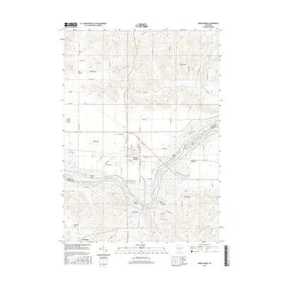
2016 Map of Spring Green
USGS Topo · Published 2016About this map
The Wisconsin River dominates this landscape, weaving through a complex network of wetlands and river features including Long Island, Sweet Island, and Hutter Slough. Near the river's edge, the small settlement of Helena and the landmark at Tower Hill sit across from the more structured street grid of Spring Green. The surrounding terrain transitions from the broad river bottom to the distinctive ridges and valleys that define this region, notably Wyoming Valley and Jones Valley to the south, and the expansive Big Hollow to the north. For those researching local history, the map identifies several significant burial sites, such as the Old Helena Cem and Big Hollow Cem. The presence of Lower Taliesin Lake 12 provides a clear link to the area's cultural heritage, while various named sloughs like Jones Slough and Cynthia Slough illustrate the dynamic nature of the river's path through the valley floor.
Find a feature on this map
84 named features on this map. Tap any name to fly to it.
Don’t see what you’re looking for? This feature index may not catch every label — zoom into the map to look around manually.
Map Details
Editions of this 2016 Spring Green Map
This is the sole edition of this map. No revisions or reprints were ever made.
Other maps of this area

1901 · Denzer
USGS Topo · 1:62,500

1905 · Richland Center
USGS Topo · 1:125,000

1920 · Blue Mounds
USGS Topo · 1:62,500

1922 · Blue Mounds
USGS Topo · 1:62,500

1957 · Madison
USGS Topo · 1:250,000

1958 · North Freedom
USGS Topo · 1:62,500

1958 · La Crosse
USGS Topo · 1:250,000

1960 · Madison
USGS Topo · 1:250,000

1960 · Plain
USGS Topo · 1:62,500

1960 · Spring Green
USGS Topo · 1:62,500