2022 Map of Spring Hill
USGS Topo · Published 2022About this map
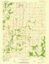
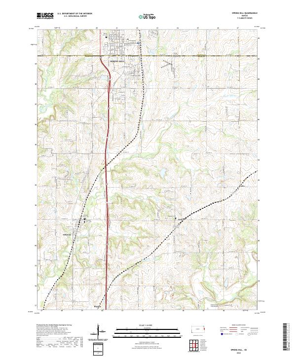
Spring Hill straddles the line between Johnson and Miami counties, serving as the primary hub for this agricultural and residential landscape in eastern Kansas. The town's grid is well-established, anchored by the Spring Hill Cem on its northern edge, while the surrounding countryside is defined by a dense network of section roads like S Clare Rd and Bucyrus Rd. The terrain is drained by a series of south-flowing waterways, including Little Bull Creek and Sweetwater Cr, which carve gentle valleys through the prairie.
Find a feature on this map
65 named features on this map. Tap any name to fly to it.
Don’t see what you’re looking for? This feature index may not catch every label — zoom into the map to look around manually.
Map Details
Editions of this 2022 Spring Hill Map
This is the sole edition of this map. No revisions or reprints were ever made.