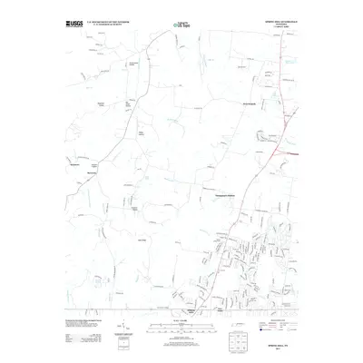
2013 Map of Spring Hill
USGS Topo · Published 2013About this map
Spring Hill and Thompson's Station anchor this Williamson County corridor during a period of modern residential growth and infrastructure expansion. The landscape is defined by the W Harpeth River and numerous forks of Murfrees Fork, which wind through a series of named hollows including Peckerwood Hollow, Dogwood Hollow, and Ridley Hollow. The historic path of the railroad is evident at Fedco Siding and McCormack Crossing, reflecting the area's transition from an agricultural rail hub to a suburban extension of the Nashville metropolitan region. To the west, the terrain rises toward Sugar Ridge and the small settlements of Burwood and Sycamore, where the rural character of the land remains more pronounced. This survey documents the complex network of local roads and subdivisions, such as Warioto Farms and Spring Green Farm, that have transformed the former plantation and farm lands between the old town centers.
Find a feature on this map
186 named features on this map. Tap any name to fly to it.
Don’t see what you’re looking for? This feature index may not catch every label — zoom into the map to look around manually.
Map Details
Editions of this 2013 Spring Hill Map
This is the sole edition of this map. No revisions or reprints were ever made.
Other maps of this area

1901 · Colombia
USGS Topo · 1:125,000

1909 · Franklin
USGS Topo · 1:62,500

1936 · Godwin
USGS Topo · 1:24,000

1936 · Rally Hill
USGS Topo · 1:24,000

1936 · Spring Hill
USGS Topo · 1:24,000

1936 · Theta
USGS Topo · 1:24,000

1936 · Carters Creek
USGS Topo · 1:24,000

1936 · Bethesda
USGS Topo · 1:24,000

1940 · Godwin
USGS Topo · 1:24,000
1941 · Godwin
USGS Topo · 1:24,000