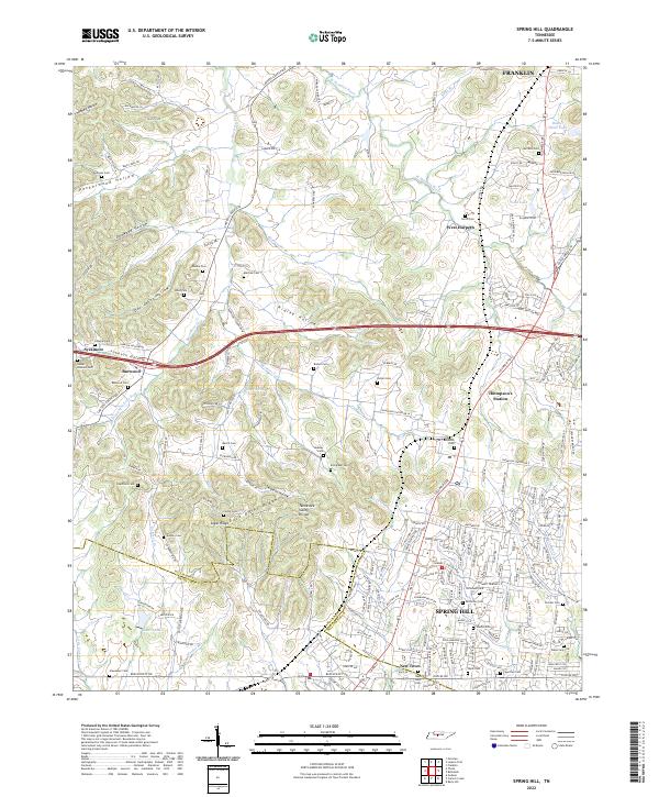
2022 Map of Spring Hill
USGS Topo · Published 2022About this map
Spring Hill and the surrounding Middle Tennessee landscape are defined here by a series of prominent ridges and family-named hollows. The Tennessee Valley Divide and Duck River Ridge create a significant topographical boundary, separating the waters that flow toward the W Harpeth River from the southern drainages like Walden Br. Smaller communities such as West Harpeth, Burwood, and Sycamore dot the northern portion of the map, connected by historical thoroughfares like Carters Creek Pike.
Find a feature on this map
217 named features on this map. Tap any name to fly to it.
Don’t see what you’re looking for? This feature index may not catch every label — zoom into the map to look around manually.
Map Details
Editions of this 2022 Spring Hill Map
This is the sole edition of this map. No revisions or reprints were ever made.
Other maps of this area

1901 · Colombia
USGS Topo · 1:125,000

1909 · Franklin
USGS Topo · 1:62,500

1936 · Godwin
USGS Topo · 1:24,000

1936 · Rally Hill
USGS Topo · 1:24,000

1936 · Spring Hill
USGS Topo · 1:24,000

1936 · Theta
USGS Topo · 1:24,000

1936 · Carters Creek
USGS Topo · 1:24,000

1936 · Bethesda
USGS Topo · 1:24,000

1940 · Godwin
USGS Topo · 1:24,000
1941 · Godwin
USGS Topo · 1:24,000