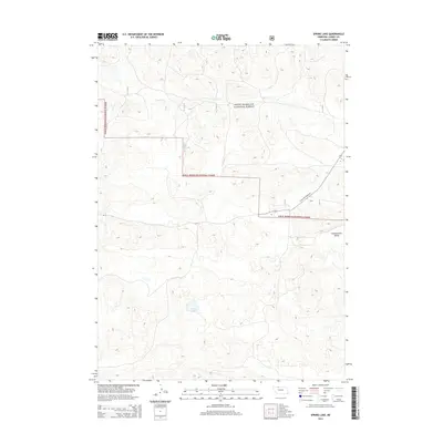
2014 Map of Spring Lake
USGS Topo · Published 2014About this map
The Sam R. McKelvie National Forest dominates this section of the Nebraska Sandhills, where a complex network of forest service roads and trails navigates a landscape defined by stabilized dunes and shallow depressions. Toward the southern end of the quadrangle, Spring Lake provides a rare perennial water source in this semi-arid environment, while the drainage of Steer Cr meanders across the northern half. Transport through this remote portion of Cherry County is anchored by Ne-97 and the specialized State Hwy Spur 16F, which provides access into the heart of the national forest. The topography transition is visible at Chamberlain Valley to the east, reflecting the characteristic geography of one of the largest grass-stabilized dune regions in the world. This 2014 survey documents the area's infrastructure and land management boundaries in a period of modern conservation and ranching.
Find a feature on this map
11 named features on this map. Tap any name to fly to it.
Don’t see what you’re looking for? This feature index may not catch every label — zoom into the map to look around manually.
Map Details
Editions of this 2014 Spring Lake Map
This is the sole edition of this map. No revisions or reprints were ever made.
Other maps of this area

1950 · Powderhorn Valley
USGS Topo · 1:62,500

1950 · Cody
USGS Topo · 1:62,500

1950 · Doughboy
USGS Topo · 1:62,500

1952 · Eli
USGS Topo · 1:62,500

1952 · Doughboy
USGS Topo · 1:62,500

1957 · Valentine
USGS Topo · 1:250,000

1959 · Valentine
USGS Topo · 1:250,000

1985 · Powderhorn Valley SW
USGS Topo · 1:24,000

1985 · Heath Valley
USGS Topo · 1:24,000

1985 · Eli SE
USGS Topo · 1:24,000