
1974 Map of Spring Lake
USGS Topo · Published 1978About this map
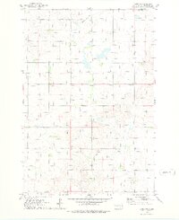
Spring Lake and the surrounding prairie wetlands of Walworth County dominate this mid-1970s topographical record. The landscape is shaped by the presence of the Chicago Milwaukee St Paul and Pacific railroad, which cuts northwest through the territory, passing the small settlement of Alamo. Evidence of earlier transport is visible in the Old RR Gr noted further north, suggesting shifts in the local rail network over time. Conservation efforts are well-established here, with the Spring Lake State Public Shooting Area and the National Waterfowl Production Area encompassing significant portions of the shoreline and adjacent marshlands. Smaller water bodies like Swan Lake and the winding Swan Creek punctuate the grid of section lines, while a lone Cem and a Radio Tower serve as the few human-made landmarks in this sparsely populated agricultural region.
Find a feature on this map
12 named features on this map. Tap any name to fly to it.
Don’t see what you’re looking for? This feature index may not catch every label — zoom into the map to look around manually.
Map Details
Editions of this 1974 Spring Lake Map
This is the sole edition of this map. No revisions or reprints were ever made.
Other maps of this area

1954 · Aberdeen
USGS Topo · 1:250,000

1956 · Aberdeen
USGS Topo · 1:250,000

1974 · Lowry
USGS Topo · 1:24,000

1974 · Hoven Muni. Airport
USGS Topo · 1:24,000
1974 · Lowry NW
USGS Topo · 1:24,000

1974 · Bowdle
USGS Topo · 1:24,000

1978 · Bowdle SW
USGS Topo · 1:24,000

1978 · Bowdle-Hosmer Lake
USGS Topo · 1:24,000

1978 · Java SE
USGS Topo · 1:24,000
1978 · Java
USGS Topo · 1:24,000