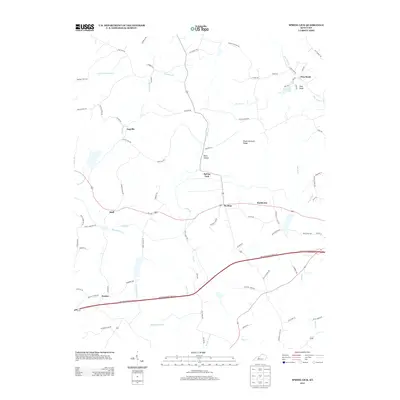
2013 Map of Spring Lick
USGS Topo · Published 2013About this map
Spring Lick serves as the central focal point for this landscape in west-central Kentucky, where small unincorporated settlements and family roads reveal the region's rural character. The map illustrates a network of hollows and ridges, most notably Peach Orchard Ridge and the nearby Kiper Hollow. Waterways like Caney Cr and Richland Cr snake through the terrain, defining the local topography and historical property lines.
Find a feature on this map
80 named features on this map. Tap any name to fly to it.
Don’t see what you’re looking for? This feature index may not catch every label — zoom into the map to look around manually.
Map Details
Editions of this 2013 Spring Lick Map
This is the sole edition of this map. No revisions or reprints were ever made.
Other maps of this area

1922 · Leitchfield
USGS Topo · 1:48,000

1925 · Spring Lick
USGS Topo · 1:62,500

1925 · Leitchfield
USGS Topo · 1:62,500

1932 · Fordsville
USGS Topo · 1:62,500

1953 · Mc Daniels
USGS Topo · 1:24,000

1953 · Ready
USGS Topo · 1:24,000

1953 · Falls Of Rough
USGS Topo · 1:24,000

1954 · Evansville
USGS Topo · 1:250,000

1954 · Spring Lick
USGS Topo · 1:24,000

1954 · Welchs Creek
USGS Topo · 1:24,000