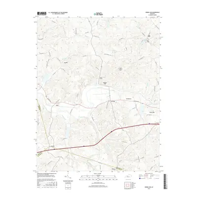
2016 Map of Spring Lick
USGS Topo · Published 2016About this map
Caneyville anchors the eastern edge of this landscape where the drainage of Caney Creek and its tributaries, including Cane Run and Buck Creek, define the topography of Grayson County. The area is characterized by a network of small, established settlements like Spring Lick and Jugville, connected by winding routes such as Richland Rd and Beaver Dam Rd. These names often reflect early local families and geography, as seen in Kiper Hollow and Peach Orchard Ridge.
Find a feature on this map
72 named features on this map. Tap any name to fly to it.
Don’t see what you’re looking for? This feature index may not catch every label — zoom into the map to look around manually.
Map Details
Editions of this 2016 Spring Lick Map
This is the sole edition of this map. No revisions or reprints were ever made.
Other maps of this area

1922 · Leitchfield
USGS Topo · 1:48,000

1925 · Spring Lick
USGS Topo · 1:62,500

1925 · Leitchfield
USGS Topo · 1:62,500

1932 · Fordsville
USGS Topo · 1:62,500

1953 · Mc Daniels
USGS Topo · 1:24,000

1953 · Ready
USGS Topo · 1:24,000

1953 · Falls Of Rough
USGS Topo · 1:24,000

1954 · Evansville
USGS Topo · 1:250,000

1954 · Spring Lick
USGS Topo · 1:24,000

1954 · Welchs Creek
USGS Topo · 1:24,000