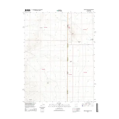
2014 Map of Spring Mountain
USGS Topo · Published 2014About this map
Spring Mountain and the high elevations of the Snake Range dominate this 2014 landscape, marking a stark geographic transition across the border of White Pine County, Nevada, and Millard County, Utah. The topography is defined by significant drainage systems and geological features, including the narrow passage of Devils Gate and the winding Devils Gate Canyon. These natural corridors historically influenced movement through the high desert, providing essential water sources such as Warm Springs and Swan Cr in an otherwise arid environment. Further south, Petes Knoll stands as a distinct landmark above the desert floor near Marble Wash. This survey reflects the modern management of this interstate region, where the intersection of state lines and public land survey systems overlays a terrain of alluvial washes like Indian George Wash and steep mountain slopes.
Find a feature on this map
17 named features on this map. Tap any name to fly to it.
Don’t see what you’re looking for? This feature index may not catch every label — zoom into the map to look around manually.
Map Details
Editions of this 2014 Spring Mountain Map
This is the sole edition of this map. No revisions or reprints were ever made.
Other maps of this area

1908 · Fish Springs
USGS Topo · 1:250,000

1910 · Fish Springs
USGS Topo · 1:250,000

1953 · Delta
USGS Topo · 1:250,000

1956 · Ely
USGS Topo · 1:250,000

1958 · Delta
USGS Topo · 1:250,000

1959 · Ely
USGS Topo · 1:250,000

1960 · Gandy
USGS Topo · 1:62,500

1961 · Trout Creek
USGS Topo · 1:62,500

1962 · Delta
USGS Topo · 1:250,000

1963 · Ely
USGS Topo · 1:250,000