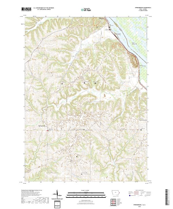
2022 Map of Springbrook
USGS Topo · Published 2022About this map
Springbrook and the southern edge of Bellevue anchor this modern topographic view of Jackson County, where the driftless-style topography descends sharply toward the Mississippi River. The landscape is defined by the winding course of Pleasant Cr and Little Mill Cr, which carve deep valleys through the agricultural uplands. A striking density of small family burial grounds, such as the Monner Farm Cem, Huff Farm Cem, Homan Farm Cem, and Heim Farm Cem, provides a detailed record of the rural homesteads that have long occupied these ridges. Along the riverfront, the map details the complex shoreline of Harrington Slough and the distinctive Island Number 249. For those interested in aviation history or local landmarks, the Bellevue Flying Circus Airport sits near the bluffs, while Sugar Camp Hollow and Bowman Island mark the natural transition from the rugged interior to the river's edge.
Find a feature on this map
72 named features on this map. Tap any name to fly to it.
Don’t see what you’re looking for? This feature index may not catch every label — zoom into the map to look around manually.
Map Details
Editions of this 2022 Springbrook Map
This is the sole edition of this map. No revisions or reprints were ever made.
Other maps of this area

1891 · Maquoketa
USGS Topo · 1:62,500

1901 · Peosta
USGS Topo · 1:125,000

1911 · Galena
USGS Topo · 1:62,500

1913 · Galena
USGS Topo · 1:62,500

1935 · East Dubuque
USGS Topo · 1:62,500

1935 · Miles
USGS Topo · 1:62,500

1940 · East Dubuque
USGS Topo · 1:62,500

1941 · Miles
USGS Topo · 1:62,500

1953 · Green Island
USGS Topo · 1:24,000

1959 · Dubuque
USGS Topo · 1:250,000