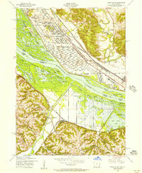
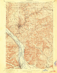
1953 Map of Green Island
USGS Topo · Published 1956About this map
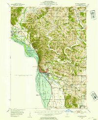
The confluence of the Maquoketa River and the Apple River with the Mississippi dominates this 1950s landscape, illustrating a complex network of backwaters and industrial corridors. On the Illinois side, the sprawling Savanna Ordnance Depot occupies a significant portion of the river terrace, defined by its rigid grid of munitions storage and rail sidings. This military installation stands in sharp contrast to the labyrinthine sloughs and islands of the Upper Mississippi River Wildlife and Fish Refuge, which includes named features like Morse Island Slough and Golden Lake.
Find a feature on this map
58 named features on this map. Tap any name to fly to it.
Don’t see what you’re looking for? This feature index may not catch every label — zoom into the map to look around manually.
Map Details
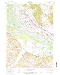
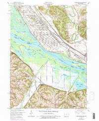
Editions of this 1953 Green Island Map
3 editions found
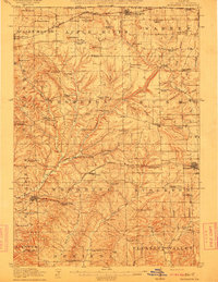
Other maps of this area

1892 · Savanna
USGS Topo · 1:62,500
1911 · Elizabeth
USGS Topo · 1:62,500

1911 · Galena
USGS Topo · 1:62,500
1913 · Galena
USGS Topo · 1:62,500
1935 · Miles
USGS Topo · 1:62,500
1936 · Elizabeth
USGS Topo · 1:62,500
1941 · Miles
USGS Topo · 1:62,500
1952 · Savanna
USGS Topo · 1:62,500
1953 · Blackhawk
USGS Topo · 1:24,000

1959 · Dubuque
USGS Topo · 1:250,000
Featured Places
- Hanover, Hanover Township
- Reeseville, IA
- Green Island, IA
- Hanover Township, IL
- Whitton, Hanover Township