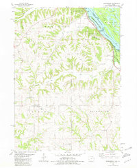
1980 Map of Springbrook
USGS Topo · Published 1981About this map
Springbrook serves as a quiet inland hub within the rolling hill country of Jackson County, positioned several miles west of the Mississippi River. This 1980 survey captures a landscape defined by deeply incised drainages like Pleasant Creek and Duck Creek, which flow through heavily wooded bluffs toward the river valley. The riverfront itself is heavily regulated for conservation and military purposes, featuring the vast Savanna Army Depot across the state line and the sprawling Upper Mississippi River Wild Life and Fish Refuge.
Find a feature on this map
33 named features on this map. Tap any name to fly to it.
Don’t see what you’re looking for? This feature index may not catch every label — zoom into the map to look around manually.
Map Details
Editions of this 1980 Springbrook Map
This is the sole edition of this map. No revisions or reprints were ever made.
Other maps of this area

1891 · Maquoketa
USGS Topo · 1:62,500

1901 · Peosta
USGS Topo · 1:125,000

1911 · Galena
USGS Topo · 1:62,500

1913 · Galena
USGS Topo · 1:62,500

1935 · East Dubuque
USGS Topo · 1:62,500

1935 · Miles
USGS Topo · 1:62,500

1940 · East Dubuque
USGS Topo · 1:62,500

1941 · Miles
USGS Topo · 1:62,500

1953 · Green Island
USGS Topo · 1:24,000

1959 · Dubuque
USGS Topo · 1:250,000