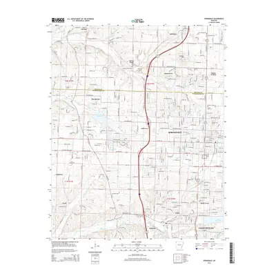
2014 Map of Springdale
USGS Topo · Published 2014About this map
Springdale and Fayetteville serve as the primary anchors for this 2014 survey of the rapidly growing corridor in Northwest Arkansas. The landscape is defined by the headwaters of several key waterways, including Brush Cr, Clear Cr, and Osage Creek, which drain the undulating terrain between the Ozark plateaus. The map documents a dense network of suburban and rural-residential expansion, yet it preserves the locations of numerous historic community centers such as Elm Springs, Tontitown, and Johnson. Significant water features like Lake Elmdale and Lake Fayetteville provide recreational focal points amidst the developments. The surveyors also noted established institutional landmarks, including Ecclesia College, and several family and community burial grounds such as Silent Grove Cem and Holcomb Cem, which offer essential data points for local genealogists tracing the settlement history of Benton and Washington counties.
Find a feature on this map
66 named features on this map. Tap any name to fly to it.
Don’t see what you’re looking for? This feature index may not catch every label — zoom into the map to look around manually.
Map Details
Editions of this 2014 Springdale Map
This is the sole edition of this map. No revisions or reprints were ever made.
Other maps of this area

1899 · Fayetteville
USGS Topo · 1:125,000

1901 · Fayetteville
USGS Topo · 1:125,000

1904 · Fayetteville
USGS Topo · 1:125,000

1954 · Tulsa
USGS Topo · 1:250,000

1958 · Sonora
USGS Topo · 1:24,000

1958 · Rogers
USGS Topo · 1:24,000

1958 · Fayetteville
USGS Topo · 1:24,000

1958 · Elkins
USGS Topo · 1:24,000

1958 · Tulsa
USGS Topo · 1:250,000

1963 · Tulsa
USGS Topo · 1:250,000