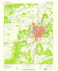
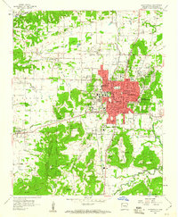
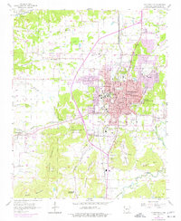
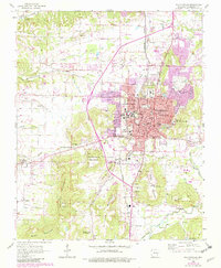
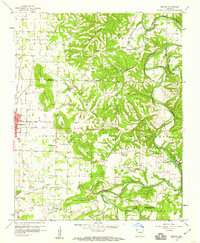
1958 Map of Fayetteville
USGS Topo · Published 1959About this map
The University of Arkansas campus and its Experimental Farm dominate the mid-century landscape of this Washington County regional hub. In the late 1950s, the city core of Fayetteville is a dense network of schools, including Leverett Sch, Washington Sch, and Root Sch, alongside prominent institutional landmarks like the Veterans Hospital and the National Cem. The St Louis San Francisco Railroad provides the primary industrial spine, running north-south through Fayette Junction.
Find a feature on this map
70 named features on this map. Tap any name to fly to it.
Don’t see what you’re looking for? This feature index may not catch every label — zoom into the map to look around manually.
Map Details
Editions of this 1958 Fayetteville Map
4 editions found
Other maps of this area

1898 · Winslow
USGS Topo · 1:125,000

1899 · Fayetteville
USGS Topo · 1:125,000

1901 · Winslow
USGS Topo · 1:125,000

1901 · Fayetteville
USGS Topo · 1:125,000

1904 · Fayetteville
USGS Topo · 1:125,000

1946 · Fort Smith
USGS Topo · 1:250,000

1954 · Tulsa
USGS Topo · 1:250,000
1958 · Sonora
USGS Topo · 1:24,000
1958 · Elkins
USGS Topo · 1:24,000

1958 · Tulsa
USGS Topo · 1:250,000