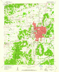
1958 Map of Fayetteville
USGS Topo · Published 1961About this map
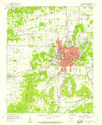
The University of Arkansas and its surrounding agricultural experimental grounds anchor this late-1950s portrait of Northwest Arkansas development. The urban core of Fayetteville expands eastward toward the ridge of Washington Mountain, while the St Louis - San Francisco Railroad carves a north-south corridor through the valley, linking the city to Fayette Junction and Greenland. This survey captures the town's institutional character, from the sprawling Veterans Hospital and National Cemetery to the cluster of neighborhood schools like Leverett Sch and Lincoln Sch. The landscape is transitioning as residential growth meets older rural landmarks such as Mt Comfort and Salem Ch. Along the periphery, family-named landmarks like McNair and various stream branches such as Clabber Creek and Hamstring Creek illustrate the enduring geography of the Ozark foothills before suburbanization further altered the terrain.
Find a feature on this map
73 named features on this map. Tap any name to fly to it.
Don’t see what you’re looking for? This feature index may not catch every label — zoom into the map to look around manually.
Map Details
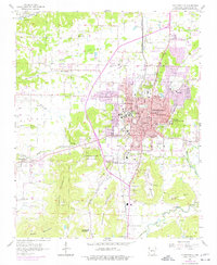
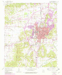
Editions of this 1958 Fayetteville Map
4 editions found
Other maps of this area

1898 · Winslow
USGS Topo · 1:125,000

1899 · Fayetteville
USGS Topo · 1:125,000

1901 · Winslow
USGS Topo · 1:125,000

1901 · Fayetteville
USGS Topo · 1:125,000

1904 · Fayetteville
USGS Topo · 1:125,000

1946 · Fort Smith
USGS Topo · 1:250,000

1954 · Tulsa
USGS Topo · 1:250,000
1958 · Sonora
USGS Topo · 1:24,000
1958 · Fayetteville
USGS Topo · 1:24,000
1958 · Elkins
USGS Topo · 1:24,000