1958 Map of Fayetteville
USGS Topo · Published 1977About this map
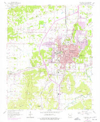
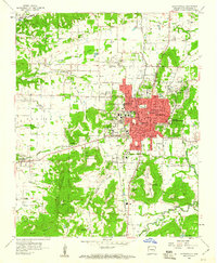
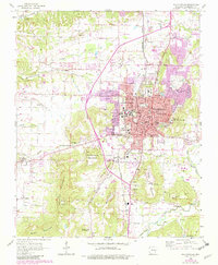
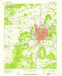
The University of Arkansas serves as the focal point for this mid-century view of Northwest Arkansas, a period marked by the town's expansion toward the surrounding ridges. The urban core of Fayetteville is densely packed with civic and educational institutions, including the Veterans Hospital, City Hospital, and a robust network of schools such as Leverett School and Bates School. The geography is defined by prominent elevations like Washington Mountain and Sequoyah Mountain, which hem in the development along the St Louis San Francisco Railroad corridor.
Find a feature on this map
83 named features on this map. Tap any name to fly to it.
Don’t see what you’re looking for? This feature index may not catch every label — zoom into the map to look around manually.
Map Details
Editions of this 1958 Fayetteville Map
4 editions found
Other maps of this area

1898 · Winslow
USGS Topo · 1:125,000

1899 · Fayetteville
USGS Topo · 1:125,000

1901 · Winslow
USGS Topo · 1:125,000

1901 · Fayetteville
USGS Topo · 1:125,000

1904 · Fayetteville
USGS Topo · 1:125,000

1946 · Fort Smith
USGS Topo · 1:250,000

1954 · Tulsa
USGS Topo · 1:250,000
1958 · Sonora
USGS Topo · 1:24,000
1958 · Fayetteville
USGS Topo · 1:24,000
1958 · Elkins
USGS Topo · 1:24,000