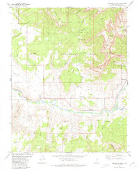
1980 Map of Springdale West
USGS Topo · Published 1980About this map
Grafton and Rockville sit along the winding course of the Virgin River in this 1980 study, capturing the intersection of early pioneer settlement and high desert wilderness. The map documents the lower reaches of Zion National Park, featuring towering landmarks like The West Temple, The Sundial, and the Towers of the Virgin. The settlement of Springdale is shown at the entrance of the canyon where the North Fork and East Fork converge.
Find a feature on this map
47 named features on this map. Tap any name to fly to it.
Don’t see what you’re looking for? This feature index may not catch every label — zoom into the map to look around manually.
Map Details
Editions of this 1980 Springdale West Map
2 editions found
Other maps of this area

1885 · St. George
USGS Topo · 1:250,000

1886 · Kanab
USGS Topo · 1:250,000

1891 · St. George
USGS Topo · 1:250,000

1953 · Cedar City
USGS Topo · 1:250,000

1954 · La Verkin 4 SE
USGS Topo · 1:24,000

1954 · La Verkin 4 NW
USGS Topo · 1:24,000

1954 · La Verkin 4 SW
USGS Topo · 1:24,000

1954 · La Verkin 1 SW
USGS Topo · 1:24,000
1956 · Springdale SW
USGS Topo · 1:24,000

1958 · Cedar City
USGS Topo · 1:250,000