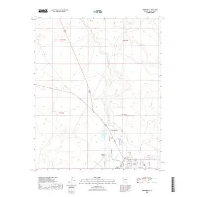
2018 Map of Springerville
USGS Topo · Published 2018About this map
Springerville and Eagar anchor this high-elevation landscape in eastern Arizona, occupying a broad basin known as Round Valley. The area is defined by the winding course of the Little Colorado River, which draws a green ribbon through the terrain as it flows northward. To the north of the main settlements, the waters of Becker Lake provide a prominent landmark, while several seasonal drainages like Nutrioso Cr and Carnero Cr feed into the river system.
Find a feature on this map
40 named features on this map. Tap any name to fly to it.
Don’t see what you’re looking for? This feature index may not catch every label — zoom into the map to look around manually.
Map Details
Editions of this 2018 Springerville Map
This is the sole edition of this map. No revisions or reprints were ever made.
Other maps of this area

1886 · St Johns
USGS Topo · 1:250,000

1892 · St Johns
USGS Topo · 1:250,000

1954 · Saint Johns
USGS Topo · 1:250,000

1957 · Saint Johns
USGS Topo · 1:250,000

1958 · Saint Johns
USGS Topo · 1:250,000

1962 · Saint Johns
USGS Topo · 1:250,000

1968 · Springerville NW
USGS Topo · 1:24,000

1969 · Coyote Hills
USGS Topo · 1:24,000
1969 · Greer
USGS Topo · 1:24,000
1969 · Eagar
USGS Topo · 1:24,000