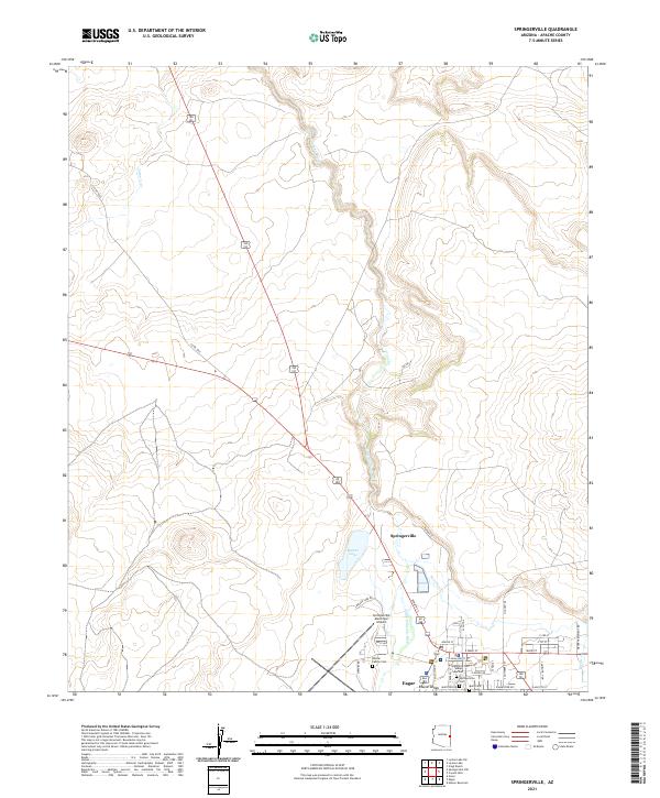
2021 Map of Springerville
USGS Topo · Published 2021About this map
Springerville and Eagar serve as the primary hubs in this high-altitude landscape where the Little Colorado River winds through the valley. This 2021 survey illustrates the modern layout of these historic eastern Arizona communities, documenting the established street grids from W Main St down to Round Valley. Local history is well-preserved through several documented burial grounds, including the Becker Family Cem, the Springerville Cem with its Lower section, and Burk Cem. The surrounding terrain is defined by its watercourses, such as Nutrioso Cr, Picnic Cr, and Carnero Cr, alongside the prominent Becker Lake. The presence of the Springerville Municipal Airport and a network of county roads like Co RD 4365 highlights the area's role as a regional crossroads near the New Mexico border.
Find a feature on this map
42 named features on this map. Tap any name to fly to it.
Don’t see what you’re looking for? This feature index may not catch every label — zoom into the map to look around manually.
Map Details
Editions of this 2021 Springerville Map
This is the sole edition of this map. No revisions or reprints were ever made.
Other maps of this area

1886 · St Johns
USGS Topo · 1:250,000

1892 · St Johns
USGS Topo · 1:250,000

1954 · Saint Johns
USGS Topo · 1:250,000

1957 · Saint Johns
USGS Topo · 1:250,000

1958 · Saint Johns
USGS Topo · 1:250,000

1962 · Saint Johns
USGS Topo · 1:250,000

1968 · Springerville NW
USGS Topo · 1:24,000

1969 · Coyote Hills
USGS Topo · 1:24,000
1969 · Greer
USGS Topo · 1:24,000
1969 · Eagar
USGS Topo · 1:24,000