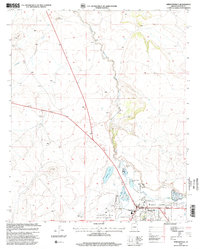
1997 Map of Springerville
USGS Topo · Published 2000About this map
The Little Colorado River winds through the high-altitude landscape of eastern Arizona, creating a narrow corridor of verdant terrain in the otherwise arid Round Valley. This 1990s revision reveals the structured growth of Springerville, serving as a vital hub for both local administration and recreation. The town’s layout is punctuated by essential civic infrastructure, including the Springerville District Office and the nearby Springerville-Eagar Municipal Airport. Agricultural and natural resource management is evident through features like the Apache N F Forest Service Pasture and several Cinder Pits dotting the volcanic landscape.
Find a feature on this map
24 named features on this map. Tap any name to fly to it.
Don’t see what you’re looking for? This feature index may not catch every label — zoom into the map to look around manually.
Map Details
Editions of this 1997 Springerville Map
This is the sole edition of this map. No revisions or reprints were ever made.
Other maps of this area

1886 · St Johns
USGS Topo · 1:250,000

1892 · St Johns
USGS Topo · 1:250,000

1954 · Saint Johns
USGS Topo · 1:250,000

1957 · Saint Johns
USGS Topo · 1:250,000

1958 · Saint Johns
USGS Topo · 1:250,000

1962 · Saint Johns
USGS Topo · 1:250,000

1968 · Springerville NW
USGS Topo · 1:24,000

1969 · Coyote Hills
USGS Topo · 1:24,000
1969 · Greer
USGS Topo · 1:24,000
1969 · Eagar
USGS Topo · 1:24,000