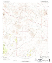
1968 Map of Springerville NW
USGS Topo · Published 1972About this map
Apache National Forest dominates the western landscape of this high-altitude Arizona survey, revealing a network of springs and volcanic features in the late 1960s. The terrain is defined by drainages like Cienega Draw and Carnero Creek, which support isolated water sources such as Schuster Spring, Gibbons Spring, and Cheney Lake. Settlement is minimal, centered primarily around Green Spot and various livestock infrastructure, including scattered corrals and a Well. Extensive cinder pits near Cerro Quemado point to the region's geological history and local industrial utility. A network of jeep trails provides the primary means of navigating this transition between forest and open range, connecting remote landmarks like a solitary Substation and a highway Rest Area along the northern corridor. The map effectively documents the mid-century water management and extractive resource patterns of this high-country landscape.
Find a feature on this map
20 named features on this map. Tap any name to fly to it.
Don’t see what you’re looking for? This feature index may not catch every label — zoom into the map to look around manually.
Map Details
Editions of this 1968 Springerville NW Map
2 editions found
Other maps of this area

1886 · St Johns
USGS Topo · 1:250,000

1892 · St Johns
USGS Topo · 1:250,000

1954 · Saint Johns
USGS Topo · 1:250,000

1957 · Saint Johns
USGS Topo · 1:250,000

1958 · Saint Johns
USGS Topo · 1:250,000

1962 · Saint Johns
USGS Topo · 1:250,000

1968 · Springerville NW
USGS Topo · 1:24,000

1969 · Whiting Knoll
USGS Topo · 1:24,000
1969 · Greer
USGS Topo · 1:24,000
1969 · Eagar
USGS Topo · 1:24,000