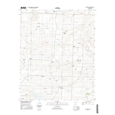
2017 Map of Springfield
USGS Topo · Published 2017About this map
Springfield and Bethlehem anchor this Conway County landscape, which transitions from the agricultural valley of Cadron Creek to the varied peaks of the Arkansas foothills. The area is defined by its long-standing rural community centers and family landmarks, including several denominational and community burial grounds such as Saint Josephs Cem at Catholic Point and the Grandview Cem to the northwest. Significant elevations like Lost Mtn, Roberts Mtn, and Ragsdale Mtn break the terrain, while numerous small waterways including Cypress Cr and Brindley Cr drain toward Brewer Lake. The presence of the Helifer Creek Ranch Airport and a network of winding local roads like Catholic Point Rd and Bethlehem Rd illustrate the modern connectivity of these traditional upland settlements.
Find a feature on this map
78 named features on this map. Tap any name to fly to it.
Don’t see what you’re looking for? This feature index may not catch every label — zoom into the map to look around manually.
Map Details
Editions of this 2017 Springfield Map
This is the sole edition of this map. No revisions or reprints were ever made.
Other maps of this area

1892 · Morrillton
USGS Topo · 1:125,000

1894 · Morrillton
USGS Topo · 1:125,000

1956 · Russellville
USGS Topo · 1:250,000

1961 · Menifee
USGS Topo · 1:24,000

1961 · Morrilton East
USGS Topo · 1:24,000

1961 · Conway
USGS Topo · 1:62,500

1961 · Bee Branch
USGS Topo · 1:62,500

1961 · Greenbrier
USGS Topo · 1:24,000

1961 · Bee Branch
USGS Topo · 1:24,000

1961 · Damascus
USGS Topo · 1:24,000