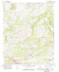
1990 Map of Springfield
USGS Topo · Published 1995About this map
Springfield and its surrounding hamlets occupy a diverse landscape of ridges and hollows in rural Conway County as documented in the 1990s. The settlement pattern is characterized by scattered communities like Center Ridge, Birdtown, and Bethlehem, often anchored by local institutions such as Nemo Vista Sch or Pleasant Springs Ch. The topography is defined by prominent elevations including Buck Ridge and Huett Mountain, with numerous watercourses like Cypress Creek and Cadron Creek carving through the terrain.
Find a feature on this map
40 named features on this map. Tap any name to fly to it.
Don’t see what you’re looking for? This feature index may not catch every label — zoom into the map to look around manually.
Map Details
Editions of this 1990 Springfield Map
This is the sole edition of this map. No revisions or reprints were ever made.
Other maps of this area

1892 · Morrillton
USGS Topo · 1:125,000

1894 · Morrillton
USGS Topo · 1:125,000

1956 · Russellville
USGS Topo · 1:250,000

1961 · Menifee
USGS Topo · 1:24,000

1961 · Morrilton East
USGS Topo · 1:24,000

1961 · Conway
USGS Topo · 1:62,500

1961 · Bee Branch
USGS Topo · 1:62,500

1961 · Greenbrier
USGS Topo · 1:24,000

1961 · Bee Branch
USGS Topo · 1:24,000

1961 · Damascus
USGS Topo · 1:24,000