
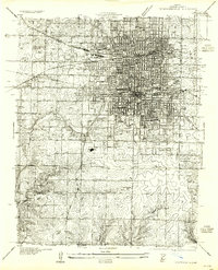
1935 Map of Springfield
USGS Topo · Published 1935About this map
Springfield in the mid-1930s is a major rail hub defined by the expansive St L-S F RR Shops and the intersection of the St Louis San Francisco and Missouri Pacific lines. The urban landscape reflects significant institutional growth, anchored by the State Teachers College and the U S Medical Center. Prominent educational landmarks like De Chantal Academy and social institutions such as the Greene Co Alms House highlight the city's civic complexity during the Depression era.
Find a feature on this map
51 named features on this map. Tap any name to fly to it.
Don’t see what you’re looking for? This feature index may not catch every label — zoom into the map to look around manually.
Map Details
Editions of this 1935 Springfield Map
2 editions found
Other maps of this area

1884 · Springfield
USGS Topo · 1:125,000

1886 · Springfield
USGS Topo · 1:125,000

1936 · Brookline
USGS Topo · 1:24,000

1937 · Galloway
USGS Topo · 1:24,000

1937 · Ozark
USGS Topo · 1:48,000

1943 · Ozark
USGS Topo · 1:62,500

1945 · Ozark
USGS Topo · 1:62,500

1946 · Bassville
USGS Topo · 1:24,000

1947 · Strafford
USGS Topo · 1:62,500

1948 · Bassville
USGS Topo · 1:24,000