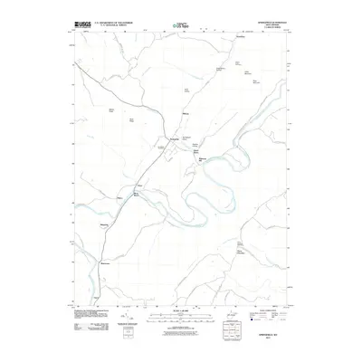
2011 Map of Springfield
USGS Topo · Published 2011About this map
The South Branch Potomac River carves a dramatic winding course through this Hampshire County landscape, defining the rural character of communities like Springfield and Three Churches. In the Springfield Valley, the local economy and geography center on traditional landmarks such as the Springfield Post Office and the riverside settlement of Millesons Mill. The terrain is characterized by prominent ridges including Middle Ridge and Valley Mountain, which separate narrow hollows and runs.
Find a feature on this map
56 named features on this map. Tap any name to fly to it.
Don’t see what you’re looking for? This feature index may not catch every label — zoom into the map to look around manually.
Map Details
Editions of this 2011 Springfield Map
This is the sole edition of this map. No revisions or reprints were ever made.
Other maps of this area

1891 · Romney
USGS Topo · 1:125,000

1898 · Frostburg
USGS Topo · 1:62,500

1899 · Flintstone
USGS Topo · 1:62,500

1900 · Flintstone
USGS Topo · 1:62,500

1901 · Frostburg
USGS Topo · 1:62,500

1908 · Frostburg
USGS Topo · 1:62,500

1920 · Keyser
USGS Topo · 1:62,500

1921 · Keyser
USGS Topo · 1:48,000

1921 · Hanging Rock
USGS Topo · 1:48,000

1922 · Keyser
USGS Topo · 1:62,500