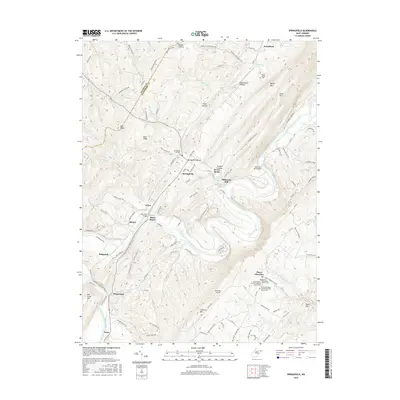
2016 Map of Springfield
USGS Topo · Published 2016About this map
The South Branch Potomac River carves a deep path through the Hampshire County highlands, defining the landscape around Springfield and the settlement of Three Churches. This 2016 survey documents the enduring rural character of the region, where the river's winding course is spanned by the John Blue Bridge and Millesons Mill Bridge. The area's spiritual and family history is anchored by several long-standing institutions, including the Mount Bethel Primitive Baptist Church Cem and the Branch Mountain United Methodist Church Cem. Along the riverbanks, small communities like Blues Beach and Wapocomo sit near traditional river crossings and landmarks such as Millesons Mill. The topography is marked by prominent ridges including Mill Creek Mtn and S Branch Mtn, which separate narrow valleys where mountain runs like Green Spring Run and Three Churches Run flow toward the main branch.
Find a feature on this map
118 named features on this map. Tap any name to fly to it.
Don’t see what you’re looking for? This feature index may not catch every label — zoom into the map to look around manually.
Map Details
Editions of this 2016 Springfield Map
This is the sole edition of this map. No revisions or reprints were ever made.
Other maps of this area

1891 · Romney
USGS Topo · 1:125,000

1898 · Frostburg
USGS Topo · 1:62,500

1899 · Flintstone
USGS Topo · 1:62,500

1900 · Flintstone
USGS Topo · 1:62,500

1901 · Frostburg
USGS Topo · 1:62,500

1908 · Frostburg
USGS Topo · 1:62,500

1920 · Keyser
USGS Topo · 1:62,500

1921 · Keyser
USGS Topo · 1:48,000

1921 · Hanging Rock
USGS Topo · 1:48,000

1922 · Keyser
USGS Topo · 1:62,500