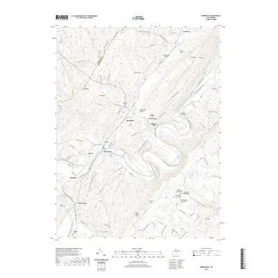
2019 Map of Springfield
USGS Topo · Published 2019About this map
The South Branch Potomac River carves a winding path through this Hampshire County landscape, dictating the placement of historic settlements and transportation routes. In the valley floor, the village of Springfield serves as a central hub near the Springfield Hill Cem, while further downstream, the small community of Millesons Mill sits near its namesake Millesons Mill Bridge. The river's influence is evident in the naming of local landmarks such as Blues Beach and Raven Rocks, providing a clear picture of how topography and water access shaped West Virginia's mountain communities.
Find a feature on this map
115 named features on this map. Tap any name to fly to it.
Don’t see what you’re looking for? This feature index may not catch every label — zoom into the map to look around manually.
Map Details
Editions of this 2019 Springfield Map
This is the sole edition of this map. No revisions or reprints were ever made.
Other maps of this area

1891 · Romney
USGS Topo · 1:125,000

1898 · Frostburg
USGS Topo · 1:62,500

1899 · Flintstone
USGS Topo · 1:62,500

1900 · Flintstone
USGS Topo · 1:62,500

1901 · Frostburg
USGS Topo · 1:62,500

1908 · Frostburg
USGS Topo · 1:62,500

1920 · Keyser
USGS Topo · 1:62,500

1921 · Keyser
USGS Topo · 1:48,000

1921 · Hanging Rock
USGS Topo · 1:48,000

1922 · Keyser
USGS Topo · 1:62,500